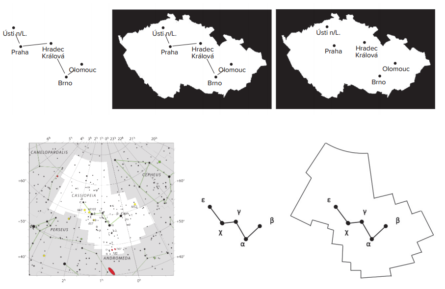

The boundaries between the constellations cannot be observed in the sky, but are plotted in maps and atlases. The boundaries of the constellations are thus similar to the boundaries between states. If we choose five of our cities and connect them on the map, we get the shape of the letter „W“. The phrase „This double-u is the Czech Republic“ is meaningless at first sight and is unlikely to be told about the state. The five points certainly do not represent the whole Czech Republic. The Czech Republic is formed by a territory where there are not only these five cities, but also a lot of other towns and villages. The sentence must therefore be amended to: „The towns forming this double-u belong to the Czech Republic.“ The exactly same situation is then valid for the grouping of stars, asterisms and constellations.